
|
|
Institute of Computer Science — Knowledge-Based Systems Research Group |
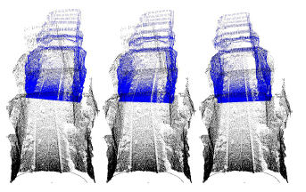
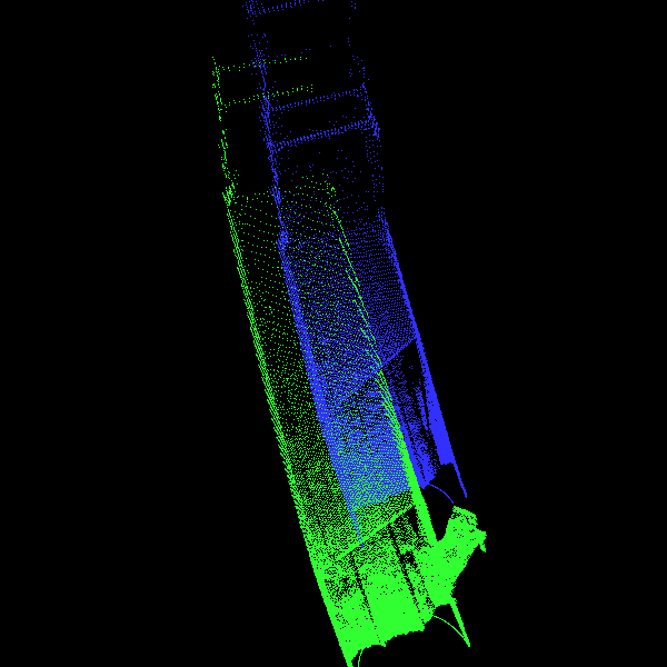
6D SLAM with Application in Autonomous Mine Mapping |
Merging 3D scans of an old mineThe scanning was done @ CMU. Thanks for the data set.You may watch the animations: Meassured and registrated 3D Points
Animation through the whole 3D scene (48 scans): |
|
Animation through the mesh of the 3D scene (points closer than 8 meters have been taken into account for the octree generation):
(animated gif 186 MB)
(DivX 53 MB)
Note: The actual scan matching is done with a global 6D error minimation.
Front view: (animated gif 4 MB) (DivX 6 MB)
Top view: (animated gif 2 MB) (DivX 6 MB)
For viewing animated gifs you may use IE, Netscape, Mozilla, Konqueror, Pixie. Best viewed with Konqueror or Pixie under Linux. Please download the animated gif before viewing. DivX AVIs can be viewed with MPlayer (Linux) or the Windows Media Player. I suggest viewing the multiple gifs on a fast computer, since there aren't any artefacts.
Many thanks to Dirk Hähnel for providing the 3D data.
Also many thanks to Kai Lingemann for converting the data into the file format used in the 3D laser scanner and Kurt3D project.